
Hail Imagery Research

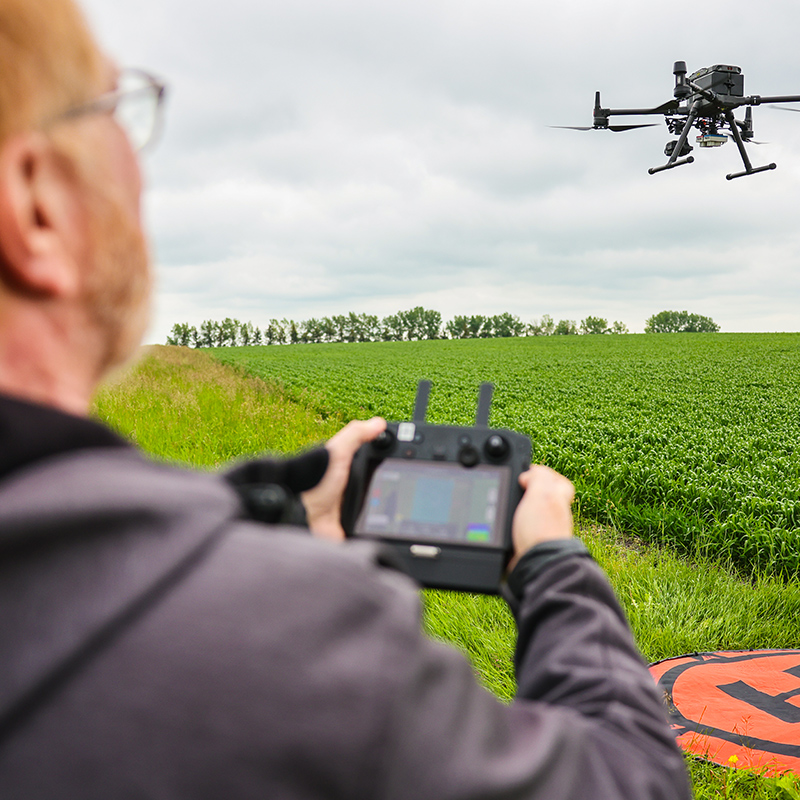
A years-long research project by Olds College Centre of Innovation (OCCI) has shown that high-definition drone imaging can not only help adjusters to better classify hail damage within cropland, but could also potentially identify other types of crop damage. The project was launched in 2021 in collaboration with Agriculture Financial Services Corporation (AFSC).

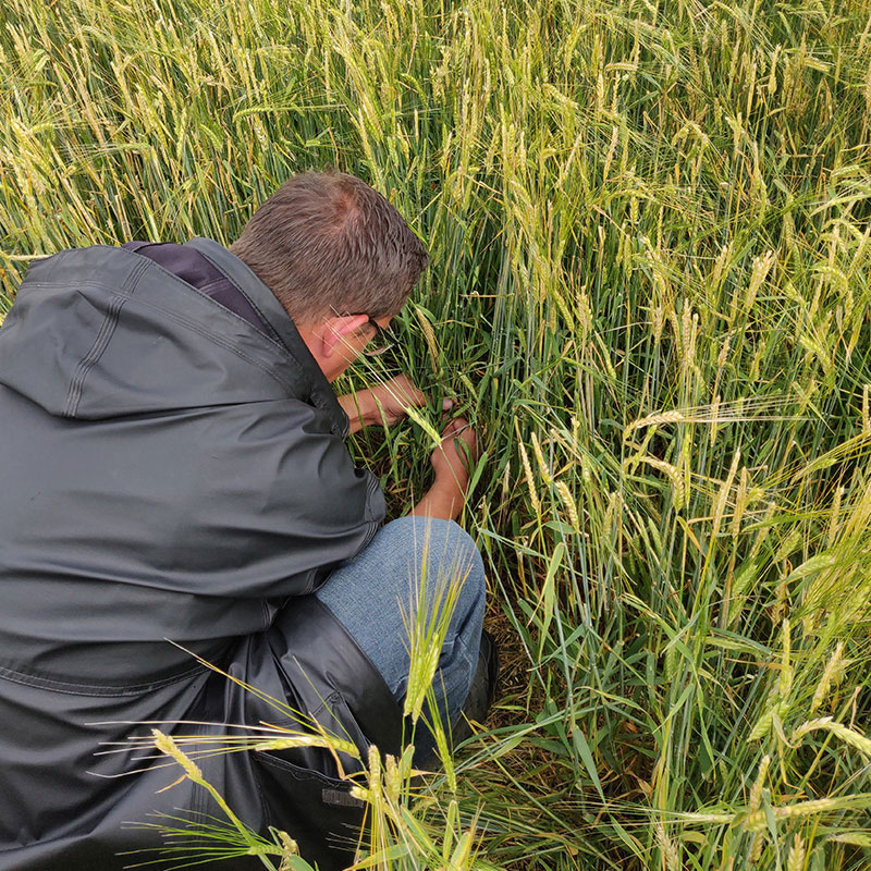
Researchers in 2023 through to 2025 used drone imagery to pre-select points to scout within fields, navigate to each point, identify the types of damage and calculate the level of hail damage using AFSC adjustment protocols. With these datasets, spatial maps were created to represent the variability of measured hail and other types of damage within fields. 

These data layers, organized within a database, could be used for future imagery analysis and training of machine learning models. These tools could not only help estimate hail damage severity, but also help identify other forms of crop damage caused by fertilizers, pesticides, insects, rodents, wildlife and flooding. The latest phase of the research project is slated to end in 2026.

Goals:

Continue database development by collecting additional sets of imagery and geospatial information of hail damaged crops to be used for software training, development and modeling. Each field is to include photos of the damage types observed, AFSC adjustment data and in-field scouting documentation. The methodology used will replicate the methodology of 2023 and 2024 to create comparable datasets of 2025:
  • Collection of aerial imagery to correlate with damage types observed via in-field scouting, for each field surveyed.
  • Iterative flights to occur on two fields to observe changes in imagery to the hail-affected crop over time.
  • Creation of hail damage variability geospatial layers using kriging methodology.

Funders/Partners: AFSC

Three people conducting a hail damage survey in a canola field. They are using a GPS pole and tablets to collect data, standing among tall green plants with yellow flowers. The sky is overcast, and a tree line is visible in the background.

2024 AFSC Hail Survey

High Density Scouting & Iterative Collection of Aerial Imagery for Damaged Fields

  • Collection of high resolution imagery of hail damaged fields by drones, paired with high density scouting, with scouting records documenting all forms of damage observed. The data collection enables the measurement and validation of field damage variability and severity assessments.
  • The use of DJI Mavic 300 paired with Zenmuse XT2 and MicaSense RedEdge-MX Dual Multispectral Sensor, as well as a  DJI Mavic 3 Multispectral (M3M) and DJI Mavic 3 Thermal (M3T) for drone imagery collection over hail damaged fields aided the team in determining field scouting locations.

View 2024 Fact Sheet

A person in a black rain jacket kneeling in a field of grain, closely examining or collecting plant samples. The grain is tall and green with heads starting to ripen, indicating a crop survey or damage assessment activity.

2023 Hail Survey

High Density Scouting & Collection of Aerial Imagery for Hail Damaged Fields

  • RGB drone imagery was beneficial to the scouters.
  • Satellite imagery is highly dependent on environmental conditions.
  • Differences in hail severity couldn't be visually distinguished using high resolution RGB drone imagery.

View 2023 Fact Sheet

A person operating a drone controller in the foreground while a large drone hovers over a green agricultural field. A landing pad is visible on the ground, and the sky is overcast, indicating a possible crop survey or monitoring activity.

2022 Hail Survey

Classification of Hail Damaged Areas using Drone Imagery

Determining the feasibility of using drone imagery to classify hail damage within a field:

  • Red edge band of multispectral imagery seems to clearly distinguish all damaged areas of a field.
  • GIS tools quickly calculated the area of the damage within a field once the classification is completed.

View 2022 Fact Sheet

2021 Proof of Concept

Hail Damage Classification in Barley using Drone Imagery

Exploring if drone imagery can be used as a tool to classify hail damaged versus undamaged areas within a crop.

  • Initial results of this proof of concept are encouraging; more study is recommended.

View 2021 Fact Sheet

Explore Research Projects